Golden eagle
Aquila chrysaetos
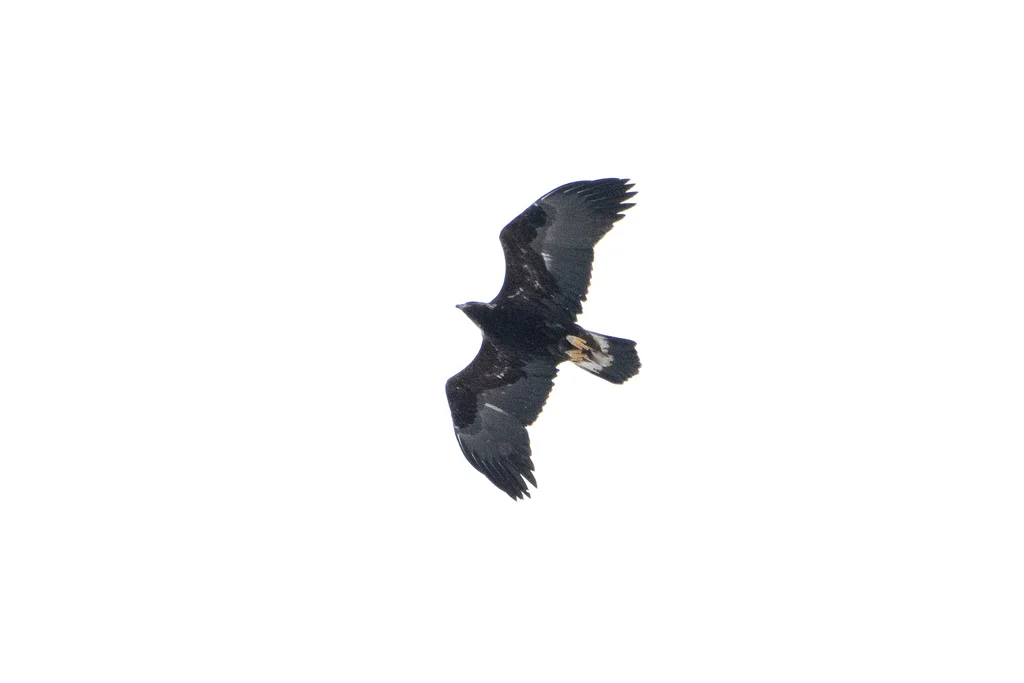
Golden eagles occur in open and semi-open habitats, including many mountain regions.

A closer look.
A golden eagle's broad wings carry it over open landscapes across much of the Northern Hemisphere. Mountain slopes and cliffs are familiar settings, although the species also uses other open or partly wooded habitats. Adults are mostly dark brown, with warmer golden feathers around the back of the head and neck. Young birds have more conspicuous pale patches in the wings and tail. As a bird of prey, the eagle searches for animals below rather than feeding on plants. Its habitat illustrates the importance of open space within a larger mountain landscape.
Conservation status
Least Concern (LC)Assessed below the thresholds for Near Threatened or a threatened category.
View assessment source (opens in a new tab)This is the status reported by the cited source. Assessments can change, and regional populations may have a different status. The check date is not the assessment date.
What do these statuses mean?
- Least Concern (LC) — Assessed below the thresholds for Near Threatened or a threatened category.
- Near Threatened (NT) — Close to qualifying for a threatened category.
- Vulnerable (VU) — A high risk of extinction in the wild.
- Endangered (EN) — A very high risk of extinction in the wild.
- Critically Endangered (CR) — An extremely high risk of extinction in the wild.
- Extinct in the Wild (EW) — Survives only in captivity, cultivation or populations outside its former range.
- Extinct (EX) — No reasonable doubt remains that the last individual has died.
- Data Deficient (DD) — Available evidence is insufficient to assess extinction risk.
- Not Evaluated (NE) — Not yet assessed against the IUCN criteria.
Colours are a simplified Nature Explorer guide. The category label and assessment scope carry the meaning. About the IUCN Red List.
Explore its wider world
Scientific sources
Another perspective.
A record of its presence.
Discover where people have documented this species.
Put discovery on the map.
Load the map to request GBIF basemap tiles and public biodiversity records.
Map data represents recorded observations and occurrences, not necessarily the complete natural range of a species. Sensitive or obscured coordinates are excluded from individual markers.